Manage “Units” : Unit health overview for SCALAR EVO Pulse/Cast
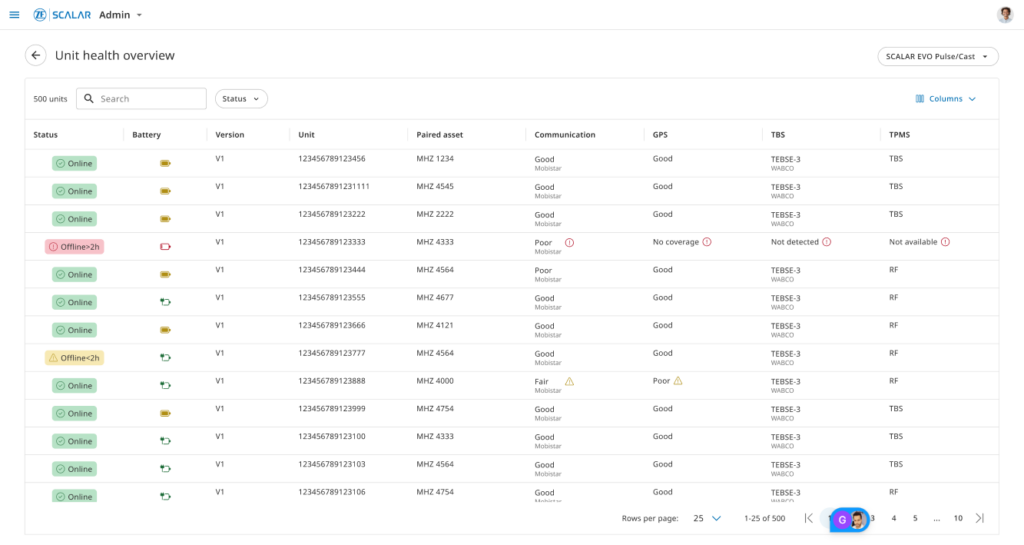
Additional screen in the module “units” (via app: Admin) to observe the health of SCALAR EVO Pulse devices installed in vehicles.
Manage “Units”
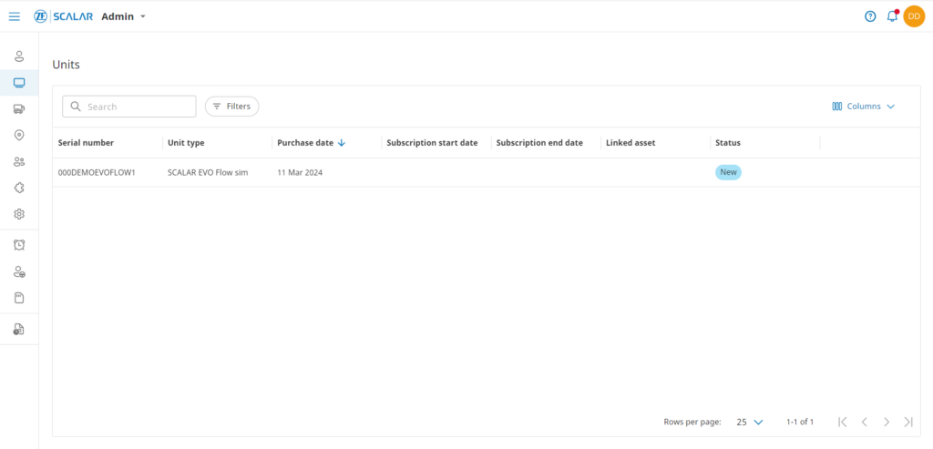
the “Units” module, one can manage units, including List view of units Drill-down view (individual unit selected) Status of unit Details about the asset which is paired with the unit Information about subscription and warranty Filter on status of units and unit type Search for units
GDPR
with European general data protection regulations while integrating data.
Software Update Management System (SUMS) (UN ECE R156)
Software Update Management System (SUMS) is a cloud-based software update management system (SUMS) that helps vehicle manufacturers (OEMs) comply with UN Regulation No. 156. It provides a secure and efficient way to manage software updates throughout the vehicle’s lifetime. SUMS automates and assists in many of the tasks involved in software update management, such […]
Combine multiple data sources on one asset
Show the data of multiple sources on a single asset on the same line in Asset Insights. For example, a trailer might be equipped with SCALAR EVO Pulse for advanced EBS, EVO Guard for security solutions and integrate their ThermoKing reefer data
Auto assignment of CU to Asset via VIN
Communication units / OBC’s get paired automatically to the right asset based on the VIN-number. That allows assets to be created beforehand, while the OBC gets paired without manual interaction upon its first activation.
Traffic information
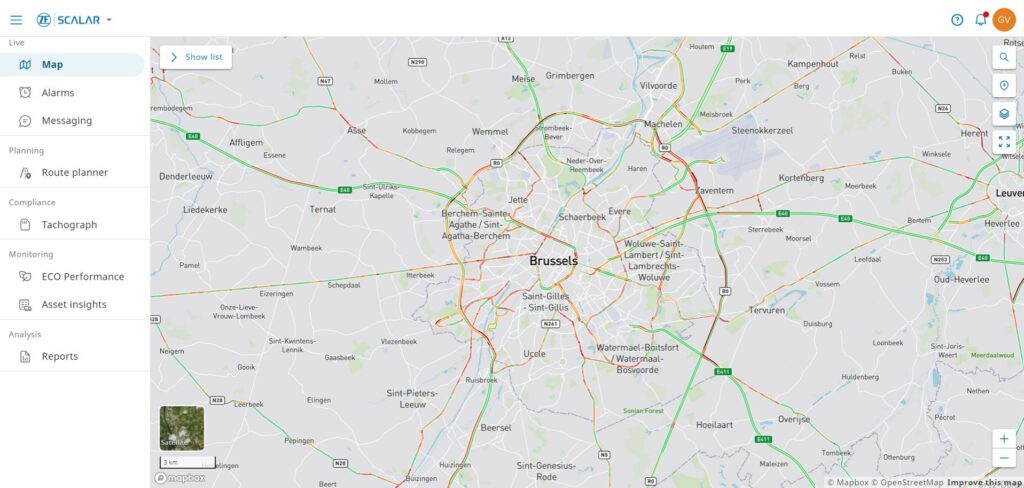
traffic on map. Some quality issues regarding map data to be fixed.
Route planner – basic
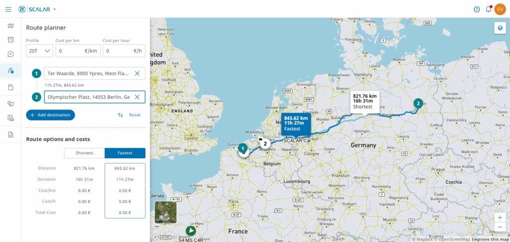
calculator, considering Start point (this could also be the current location of the asset), end point and via-points Different vehicle profiles Cost/hour/km The calculated route includes Route visualization on map with comparison table : fastest route versus shortest distance
Report – Distance
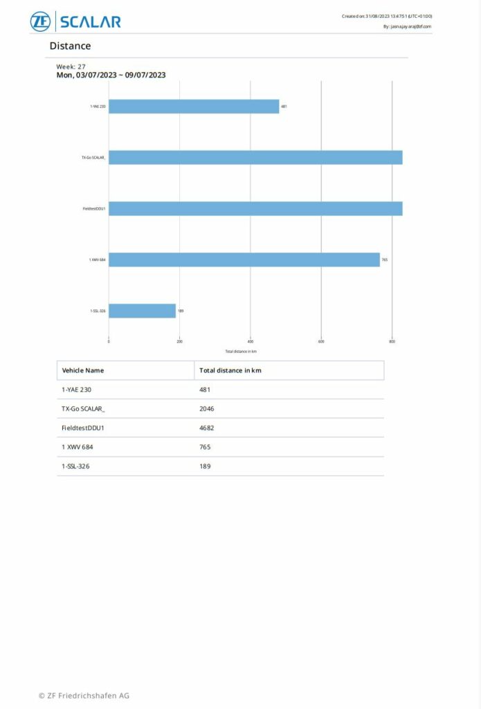
of distance travelled.
Report – Border crossing
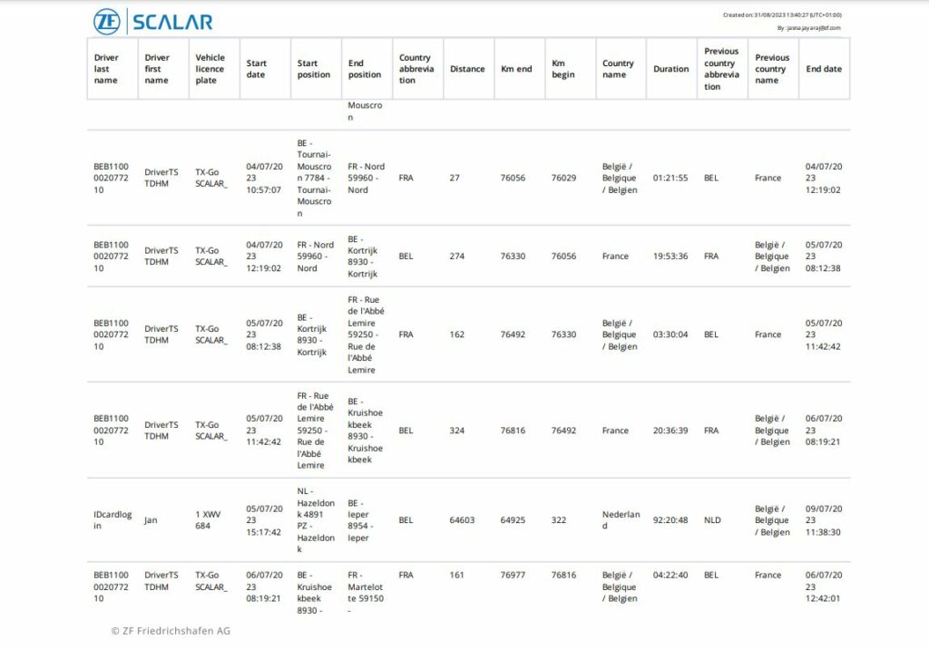
of border crossing events.