Route planner – basic
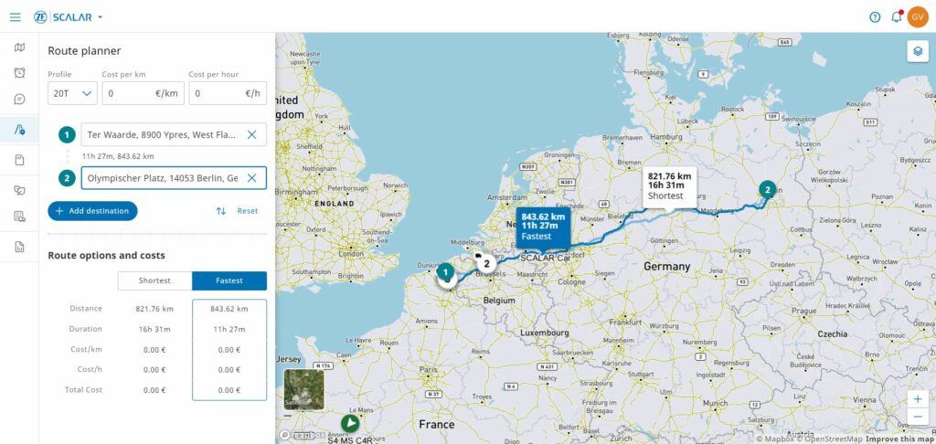
Route calculator, considering Start point (this could also be the current location of the asset), end point and via-points Different vehicle profiles Cost/hour/km The calculated route includes Route visualization on map with comparison table : fastest route versus shortest distance
Report – Distance
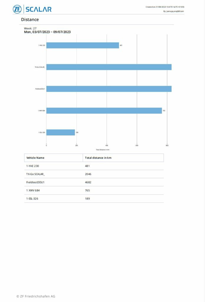
Overview of distance travelled.
Report – Border crossing
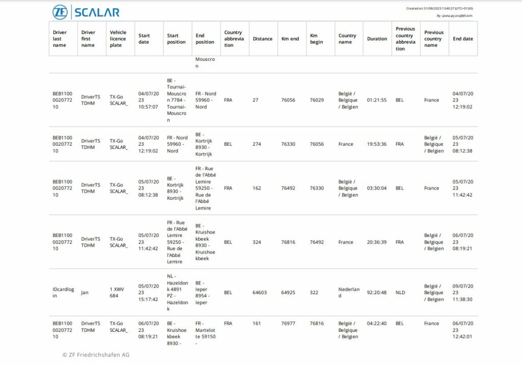
Overview of border crossing events.
Report – Alarms
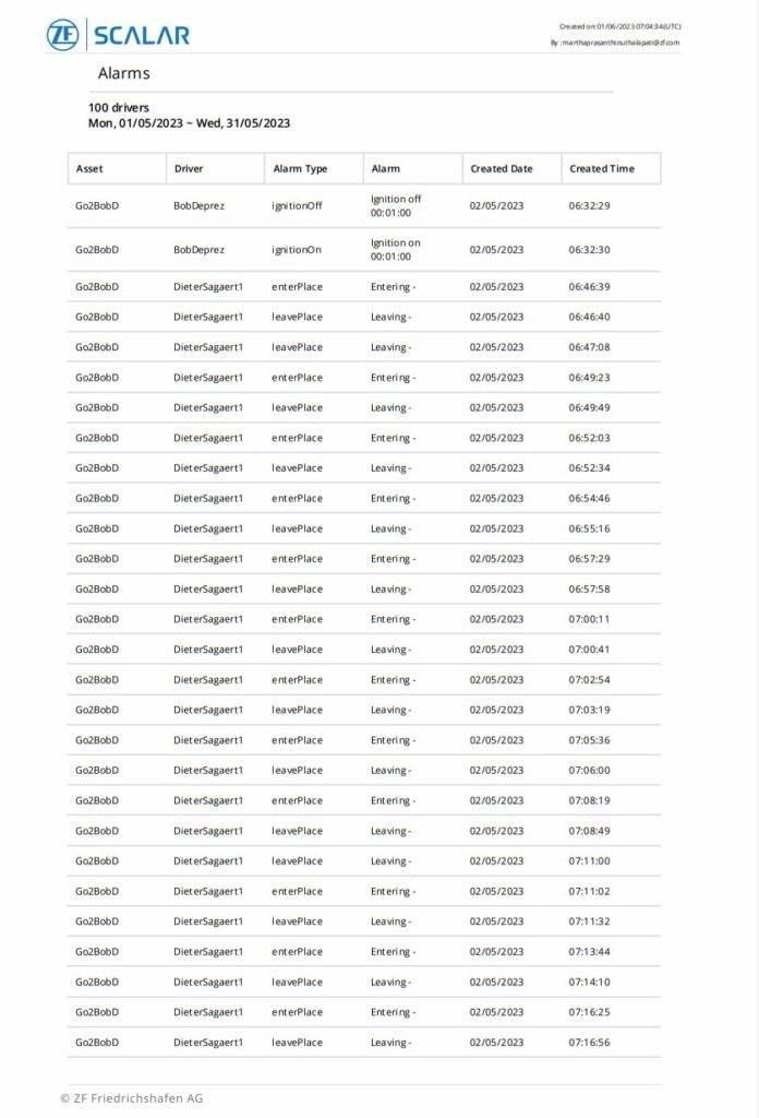
Overview of all alarms.
Report – Activity
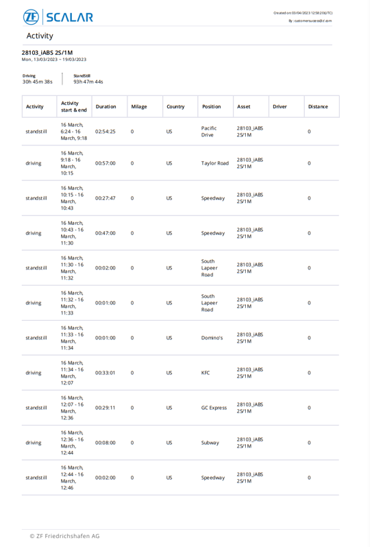
Overview of activities – driving & standstill.
Live tracking
Live tracking of assets on map & list view. This includes: Current asset location Activity overview as registered by connectivity device : driving & standstill Visualize route on map (last 24 hours only)
Historical tracking
Historical view on activities and routes View historical route on map
Driver ID manual and via tacho
Register driver identification with details manually and via tachograph & driver card.
Alarm – Ignition
Get alerted when the driver has turned on the ignition of the truck.
Alarm – Engine alarm
Get alerted on specific engine conditions.